Tuesday, 21 June 2016

Post walk thoughts

So after something like 9 months, my planning and preperation came good, I succeeded in doing something that I had to do, a long distance walk. It was hard at times, it was a mental nightmare at others, but I was determined to finish. I must be honest, it wasn't quite as hard as I was expecting, I got over the daily aches and pains pretty quick once I'd showered and relaxed with an evening meal, a pint and along with Liz's company also the companionship most nights with fellow PW walkers you meet.
The highlights for me, the views of High and Low Force waterfalls, the beauty of the Yorkshire Dales, the wild remote Cheviot Hills but view wise the geographical wonder of High Cup. I have seen many wonderful sights in the world, amongst them my childhood dream The Grand Canyon, but seeing High Cup got the same reaction from me as seeing that.
The people you meet on a day to day basis, that keep turning up for a number of days until your schedules start to differ, these are people from all walks of life, aiming to fulfill the same goal as yourself. These are people you will more than likely never meet again, Dutch, Texans, Australians all corners of the UK, but for a few days in your life, these become friends, real friends, strange.
Would I walk the Pennine Way again, I know its never say never, but I would say no. My body could take it, that I've just proved, but I don't think I could mentaly prepare myself like that again for a repeat. There are plenty more distance walks in this country to do, and seeing people the last two weeks a lot older than my 65 years, I could easily attempt more.
The downsides ................ none at all
Thanks feet, you done me proud
Signing the PW book
Thanks to the Brewery
Thanks Lew
The pride you get from a piece of printed card

Day 18 Windy Gyle to Kirk Yetholm

14 miles (monday)
And so to where we left off yesterday, a tiring walk from the bottom of the valley upon to Windy Gyle. Because we had a very leisurely stroll down from there the previous day, we actually got to the top in the same amount of time, just under the hour mark. Much the same as yesterday, fantastic views all around, I just wish photos could to it justice, shame really. We walked the ups and downs and the time passed quickly, we eventually reached decision time, do we go up a path to reach the top of Cheviot Hill itself, a supposedly drab featureless summit, or carry on the main trail. I never will see the top of that hill, and I couldn't give a monkeys uncle, after 260 miles walking I fancied a rest.

It was then a short trek onto Auchopes Cairn, but a real knee jerking descent, Lew was feeling the rigours of the descent in his ankles, but in true Devonian style he carried on regardless. At this the point we came to the  second refuge hut we'd came across on the Cheviots this one though was bloody packed, a group of ladies from Taunton were finishing the PW today also. We had a brief chat, they had supped a bottle of pre celebratory wine, Lew and myself had to make do with water and lucozade. They soon went, and the two of us had a quick lunch and got underway.


Looking over to the Schill
We had a steep climb up onto the Schill, a fine looking hill, and shortly after going down this we were again at decision time. The trail splits and you have the option, taking an high route to Kirk Yetholm or a lower route. As the song goes "You take the high road, and I'll take the low road , and I''ll be in Scotland afore ye", and thats what I did, and Lew, no brainwork needed over that decision either. We soon came to a fingerpost, oh boy I'm going to get there, a mere 4 1/2 miles to Kirk Yetholm,
settle down Mick, youre not there yet. I said to Lew that I shouldn't tempt fate, but so far on this PW walk I have not slipped or fell down (unusual I must admit). Come on Mick don't &$^** it up now. I didnt, and after a seemingly endless walk into Kirk Yetholm,

there outside The Border Hotel was my dear wife Liz waiting to greet me. We were both emotional, sorry, very emotional. I made my way into The Border, claimed my free half pint of beer, signed the PW book and recieved my PW certificate. After the back slapping and the like we then all finally made our ways home, thanks Lew you made my first stage and last two memorable. Pity there wasnt a free beer for you, next pints on me mate.

Day 17 Byreness to Windy Gyle

15 miles (Sunday)
The last section of my walk is split over two days, at a long long 26 miles over the Cheviot Hills, I have done what the majority of PW walkers do. Using Forest View in Byreness as our accommodation, they do a package over two days which includes a pickup at the halfway stage, then a return to the same place on the next day. Setting out just after 9:00, myself and good friend Lew, who made the long journey with his wife Jo to complete these last two stages with me, the pair of us soon made good work of ascending Byreness Hill. If theres one thing the Pennine Way does, it makes you work bloody hard at the start of each day.
Looking back down the steep ascent of Byreness Hill
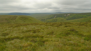
We then made our way on an easy track to follow, and immediately we were stunned by the views of the Cheviot Hills. These hills have some of the finest views imaginable, all in front and to the sides of you as far as the eye can see, wonderful. They also have something that plenty of places on the PW have, bogs, bogs and more bogs, alright there are a reasonable number of stone flagged paths and duckboards to walk and keep your feet dry, but when there isn't you soon find about it. We took an alternative PW route that cuts out Chew Green, the site where there used to be Roman camps, this saved us a half mile. When we saw the descent then ascent of the other way, we made the right choice I'm certain.

                                                       Random photos of the Cheviot Hills


We took our lunch break in a mountain refuge hut just before the climb up onto Lamb Hill, then it was then a matter of taking in the views as we made our way to Windy Gyle, the halfway mark for us over the two days.
Lew at the mountain refuge hut

A sure thing that many lives have been saved by these bothy's


Russells cairn, top of Windy Gyle
From here it was approximately two miles down into the valley to wait for the pick up. It was a reasonably steep descent at times, but was ok underfoot and we had a good half an hour spare to wait for the pick up, so no rush. The trouble though, we came down today, tomorrow morning when we are brought back..........................

Day 16 Bellingham to Byreness

Saturday 15 miles
From all accounts I've read this stage is just a rather mudane walk, a comfort walk to get you ready for the final stage/stages over the Cheviot Hills. In fact I enjoyed most of the days walk, the usual uphill start to get from Bellingham to reach the high ground, then pleasant undulating hills and moorland. There isn't a great deal of excitng things to see, can't think of any really, just pleasant walking. This changes soon after the halfway mark, and the same as yesterday you encounter forest plantations. Not as muddy as the previous day thankfully, the drawback today is when you reach the forestry track that takes you down near Byreness. A very monotonous track stretching for about 3 miles, hardly any grass verges you could use for softer walking, but at least it was fairly smooth, unlike some of the horrendous tracks  I've had to endure. As you reach the end of this track, its then a pleasant riverside walk up to Byreness, reaching the b&b for two nights, Forest View. This place is a godsend for PW walkers as its about the only accommodation for miles, run by the always busy Colin and Joyce.
A few random photos of the days walk


Friday, 17 June 2016

Day 15 Burnhead (Hadrians Wall) to Bellingham 17 miles

Day 15

Start of the day was to pick up the PW on Hadrians Wall, this is where I finished yesterday, on the roller coaster that this section is. Of course that is how it continued for just over 2 hours, this turned out to be the most demanding 2 hours start of any of the previous days. Most interesting part of this section today was at Sycamore Gap, the location was used in the Kevin Costner film, "Robin Hood, Prince of Thieves".
Sycamore Gap

Sycamore Gap
 Few more random photos on Hadrians Wall


Milecastle 39

By the time I was ready to leave Hadrian's Wall I was happy, happy in seeing a fair distance walking on relatively flat terrain.
Path leading away from Hadrian's Wall
Shortly after crossing grassy moorland I came to my first encounter with forestry plantations on the PW. It started off ok, bit dismal on the road tracks then I had a few sections on walk paths only. This is where I  come across mud, mud, mud and more mud, it was everywhere, squelching through was a grind. You eventually leave, but only for a short while, then its back in for some more. I was determined it would not get me down, and it didn't, I felt in good spirits, I was enjoying it. I forget to mention, it had been raining off and on since I set out earlier, this lasted all day, but yet I was still enjoying my day.

There was a short section of road walking, just a road, never saw a vehicle on it the time I was there. Then comes a walk past the wonderful named Shitlington Hall, followed by a walk up onto Shitlington Crags, ok tiny things please tiny minds. I was still feeling on top of the world, I felt just like a pig in Shitlington.
Shitlington Hall

Shitlington Crags

View off Shitlington Crags
After this it was a matter of getting across fields down into the nights accommodation, Riverdale Hotel in Bellingham. Looking forward to tomorrow now, from all accounts a rather mundane days walk to Byreness, but when I get there I will be able to welcome Lew and Jo, two good friends of ours. Lew is joining me on the last two days, so heres looking forward to a meet up tomorrow night and hopefully two clear dry days walking over the Cheviot Hills

Thursday, 16 June 2016

Day 14 Burnstones to Burnhead (Hadrian's Wall)

Day 14 15 miles

Not a spectacular sightseeing day, mainly fields and moorland, but eventually you get the historic Hadrian's Wall to see. I had Liz drop me off at Burnstones, the place I done a short walk to, from Alston yesterday. It was straightaway into fields with long wet grass, a bit boggy underfoot in places, helping to get my boots wet. Crossing a road near to Lambley, it was then onto Hartleyburn Common, then Blenkinsopp Common which as a reputation as being the worst area for bogs on the Pennine Way. Must have been my lucky day, there was less bog and wetness than a few miles earlier that I'd walked through. Coming off the common by Black Hill I did find navigation a bit of a problem, the track just disappears, use of a gps signal on my phone then gave me coordinates to check on my OS map, problem solved.
I then had the job of crossing the busy A69, when your feet and legs are tiring you need to wait for a pretty long gap in the traffic. After I had got across, the next thing was to navigate around Haltwhistle golf club, no problem, but if you somehow don't go over the stiles you have to, you can spend a bit of time getting back to the correct place. What a bloody idiot, for the life of me I just don't know what I was doing. I lost a good half an hour back and forward, going in a circle before I realised what a bloody silly thing I'd done. In fact when I caught up with Liz later in the afternoon, who keeps an eye on my progress and whereabouts using something called "Buddy Beacon" on the View Ranger app, she happened to mention to me, "Who went backwards and forwards and got lost about 1-00PM". Sod off Liz, can't hide anything, besides I never get lost, I don't always know where I am.
Things then got alright, easily picking up the PW trail alongside Hadrian's Wall track, soon came across a picnic area where I stopped for my lunch. Then it was roughly 3 to 4 miles along the wall path, up then down, up then down, like a roller coaster until I reached a lane to take me to our b&b for the night,
Bridgehouse B&B, within spitting distance of the Milecastle Inn. Easily the best place we have stopped in so far.
A few random photos of todays walk


Stiles that walkers love
 A few photos on and around Hadrians Wall
Thirlwell Castle

Wednesday, 15 June 2016

Day 13 Alston to Burnstones

Day 13
Today was pencilled in as a probable rest day, but after seeing the distance to my next destination near to Cawfield Crags on Hadrian's Wall would be over 20 miles, I took the opportunity to eat some of the mileage away. I set out around 8-30 using the South Tynedale railway track and Pennine Way as far as Burnstones. This took off 7 miles, thus making a more comfortable walk tomorrow. This also gives me (maybe) the chance to catch the 2-00pm kick off, England v Wales at the Milecastle Inn, within spitting distance of our nights b&b.
Liz picked me up at Burnstones around 11-00, and then we shared an intimate moment a few hours later. As we were this far north, I had it planned to take us up to Gretna Green, not exactly a place you pass often. We got there, we then went to the Old Smithy, the place where the wedding ceremonies used to take place over the last couple of centuries. They still do ceremonies today, they also do vow renewals....... so me and my dear wife Liz, paid the price to have our vows renewed. I must say it was delightful, we both got very emotional, a memory that we will cherish as much as our wedding day 8 years ago.
Back to the days walk, nothing of note to say, just a matter of getting mileage out the way, only took 1 photo, a village sign I saw, the strange and querky named Slaggyford.

Tuesday, 14 June 2016

Day 12 Dufton to Alston

Day 12 19 miles

Ever since I started this Pennine Way walk I have tried to think of the days walk in front of you, nothing else, one day at a time, thats all. But, all along there was one thing I could not block from my mind, the climb of nearly 900 metres over Cross Fell. Not so much of the height gain, not so much the distance, the biggest fear was what the weather could be like. Thick mist, extra strong winds are notorious on this fell, it was always my biggest worry.
I woke around 6-00, looked outside the b&b window, yes yes yes, clear and dry, high clouds, no hot sun, thankyou oh thankyou. Daan and Inge were in the same b&b as myself so we arranged to walk together again. We set off at 7-45 walking down to pick up the PW trail, perfect ideal weather conditions, we could see straight away onto the top of Great Dun Fell, the large "golf ball" or the Civil Aviation Authority's air traffic control radar, take your pick. Passing by the impressive looking Dufton Pike, we made good progress along gradual ascending tracks up to the fells. There was only two short steep ascents, onto Green Fell then Knock Fell.
Dufton Pike
"Golf ball" on top of Great Dun Fell
It was then a easier walk than I was expecting, onto Great Dun Fell, Little Dun Fell then the huge expanse of Cross Fell. We sat and had a quick break on Cross Fell, taking in wonderful views of the Lake District peaks in the distance.
Down between the Dun Fells, Cross Fell behind
Looking back to Great Dun Fell
Cross Fell summit shelter

I take in views of Lake District skyline
After we had came off Cross Fell we took our lunch break at Greggs Hut, an old cottage converted into a mountain rescue bothy named after mountaineer John Gregory, killed in the Alps 1968.
Greg's Hut
Hard work all this walking
Once we had left here it was a long, very long walk to the village of Garrigill, a nice sleepy little place. This was followed by a riverside walk to the evenings accommodation in the small town of Alston.
Fantastic clouds, walking into Alston. (photo taken by Daan)